

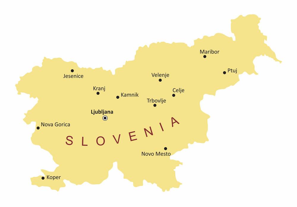
You can find on this page the Slovenia cities map to print and to download in PDF. The Slovenia map city presents main cities, towns and presents the capital of Slovenia in Southern Europe.

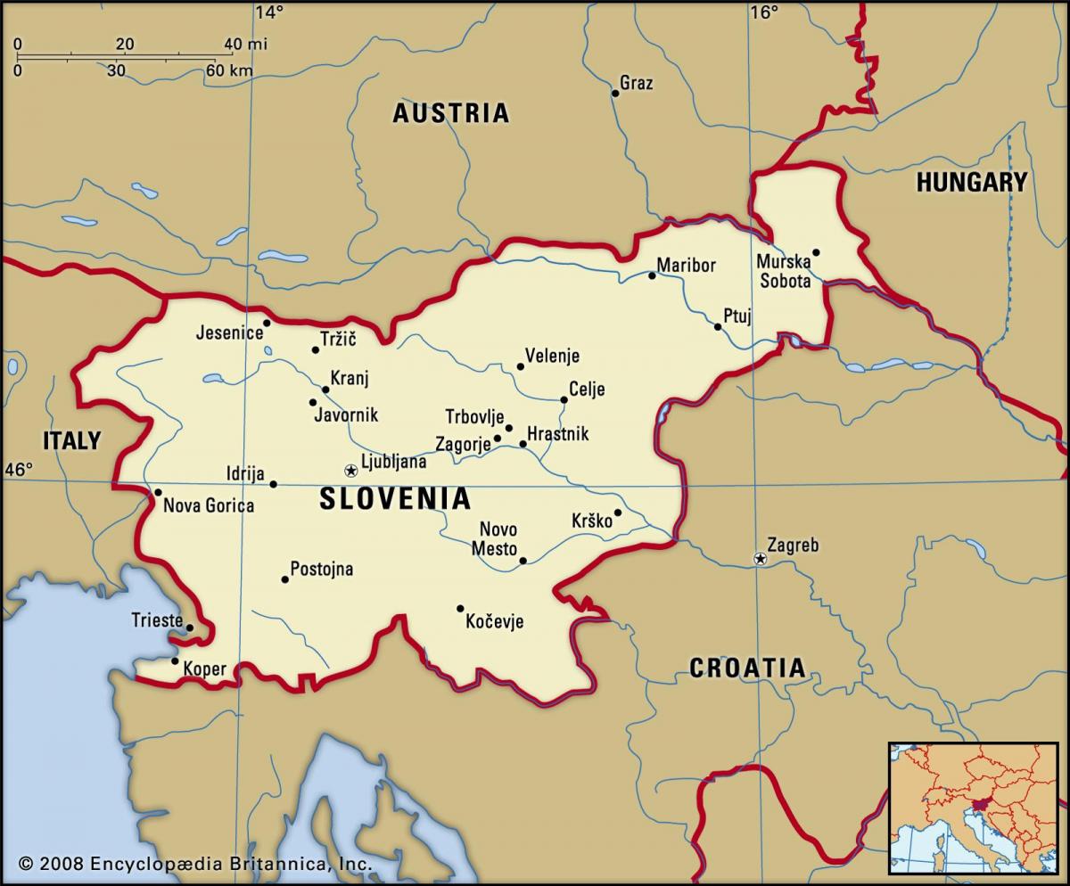
The map of Slovenia with cities shows all big and medium towns of Slovenia. This map of cities of Slovenia will allow you to easily find the city where you want to travel in Slovenia in Southern Europe. The Slovenia cities map is downloadable in PDF, printable and free.
Planning a trip to Slovenia is an opportunity to see a variety of destinations that include vibrant cities, charming villages, snow-capped mountains and scenic beaches. As one of the oldest coastal cities in Slovenia, and a major port, Koper is an integral part of the country infrastructure. This is yet another coastal spot that was once part of the Venetian Empire, and it formally went by the name Caprea. Later, it became part of Yugoslavia. Today, Koper is a lesser-known destination that nevertheless offers several enjoyable attractions. Popular for winter sports enthusiasts is the destination of Kranjska Gora city, located in the northwest of Slovenia as you can see in the Map of Slovenia with cities. During the winter, Kranjska Gora is busy with visitors who ski and snowboard in the resort of Vitranc, taking advantage of the frequent snowfall and the steep trails.
One of the oldest cities in all of Slovenia is Celje, a small city perched on the banks of the Savinja River. The biggest attraction in the city is the enormous castle, which was erected in the 14th century and now looks down over the city from its hilltop location. The best way to spend a day in Celje is to walk through Old Celje, the historic downtown where buildings date back to medieval times and you can stroll along cobblestone roads, dine at traditional eateries and admire the traditional architecture throughout the city. On the banks of the Drava River is the city of Ptuj, a destination in Eastern Slovenia with an impressive collection of historic architecture as its shown in the Map of Slovenia with cities. Ptuj is widely regarded as one of the oldest cities in the nation, and it has been important in the local culture since the Stone Age.
Slovenia Cities as its mentioned in the Map of Slovenia with cities: Celje, Domzale, Dranj, Grosuplje, Jesenice, Kamnik, Kobarid, Koper, Kozina, Kranj, Litija, Ljubljana, Maribor, Menges, Murska, Nova Gorica, Novo Mesto, Postojna, Ptuj, Ravne, Rob, Sobota, Trbovlje, Velenje and Visnja Gora. Postojna is a relatively small town in Southwest Slovenia, but it is a must-see destination for travelers drawn to unique attractions and natural scenery. Postojna is known for its extensive cave system, which boasts a staggering 20 km (13 miles) of chambers, hallways and galleries, some of which have ceilings nearly 50 meters (150 feet) high. Skofja Loka is just a short car drive from Ljubljana and has a much more quaint, charming appeal. This sleepy city sits on the Sora river and has an imposing caste overlooking the town from above. This is the perfect day trip from Ljubljana and will take only 1-2 hours to explore.
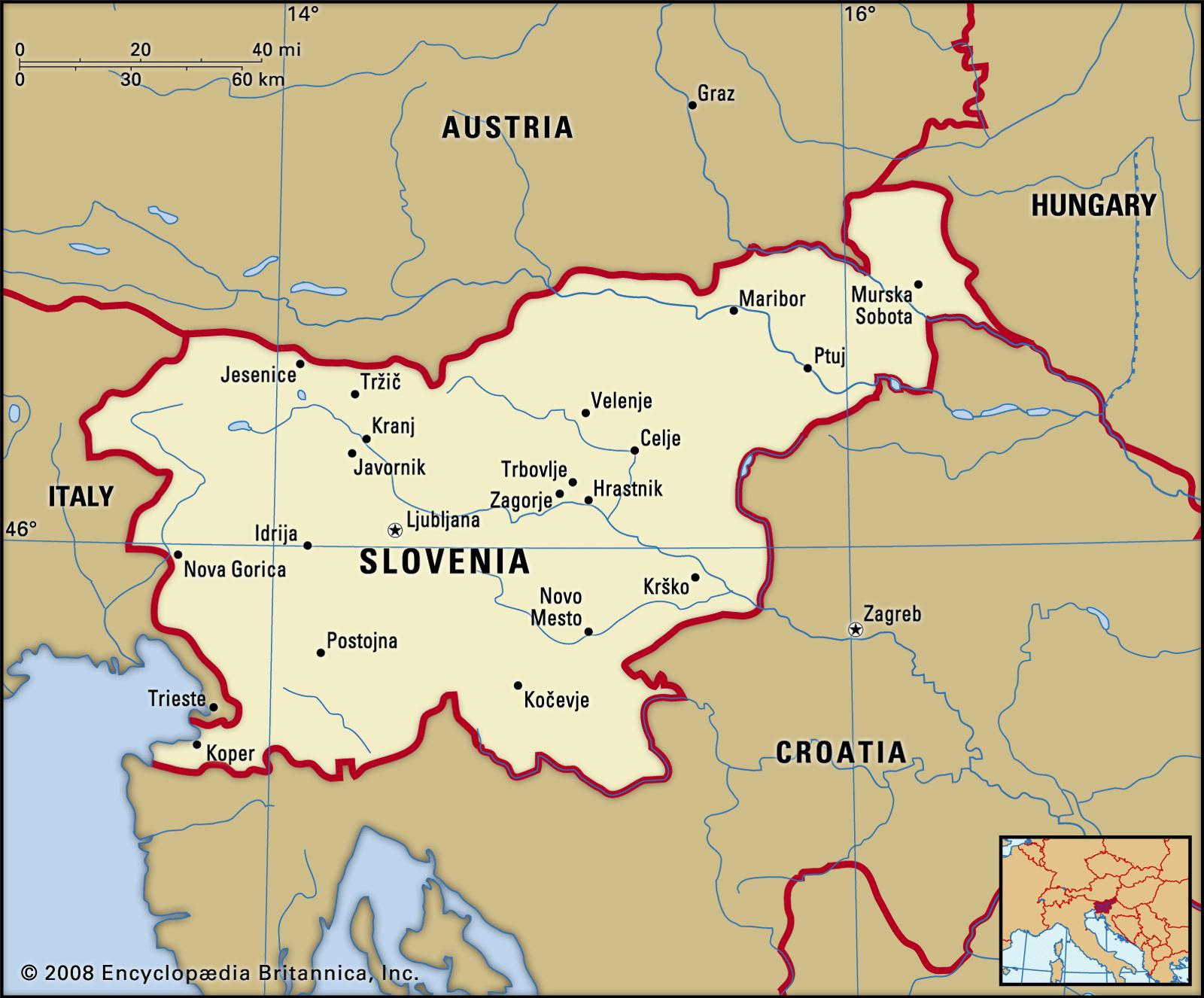
The map of Slovenia with major cities shows all biggest and main towns of Slovenia. This map of major cities of Slovenia will allow you to easily find the big city where you want to travel in Slovenia in Southern Europe. The Slovenia major cities map is downloadable in PDF, printable and free.
Ljubljana is Slovenia biggest city and the seat of government in the country. The city has a long and rich history. It was once the site of Emona, an ancient Roman city and from the Middle Ages to 1918 until the dissolution of the Austro-Hungarian Empire, Ljubljana was under Habsburg rule. The city is strategically situated between the trade route that connects the Danube region to the northern Adriatic Sea as you can see in the Map of Slovenia with major cities. Currently, it is the economic, political, administrative, and educational hub of the country. The major industries active in this city include food processing, pharmaceuticals, and petrochemicals. Transport, skilled trades, construction, banking, finance, etc., are the other major employers active in this region. Ljubljana hosts over 10,000 cultural events including many international arts, theater, and music festivals.
Maribor is Slovenia second biggest city and the seat of the City Municipality of Maribor. Maribor hosts a number of historical structures such as the Water Tower, the Judgement Tower, the Jewish Tower, and others. The Maribor Cathedral and the Maribor Synagogue are religious buildings constructed in the 13th and 14th centuries respectively. Several castles like the Betnava Catle, Maribor Castle, etc., are present in this city as its shown in the Map of Slovenia with major cities. The University of Maribor and several other educational institutions are also located in Maribor. Celje is the third largest city in Slovenia. The city is City Municipality of Celje administrative seat. Celje also serves as a regional center of the Styria, a traditional Slovenian region. Celje is located at the confluence of four rivers in the Lower Savinja Valley below the 1,335 feet tall Upper Celje Castle. The city is at an elevation of 781 feet above sea level. In 1991, the city of Celje became a part of independent Slovenia following the Ten-Day War. The Grayfriars monastery that was established in 1241 and a palace founded in the 16th century are the two major attractions of this Slovenian city.
Ranking fourth among the biggest cities in Slovenia, Kranj is located only 20 km northwest of the capital city of the country, Ljubljana. The city acts as the center of the City Municipality of Kranj. It also serves as the regional center of the traditional region of Upper Carniola. Kranj is primarily an industrial city with electronics and rubber being the biggest industries here. Velenje is the fifth biggest city in Slovenia and the center of the Slovenian Municipality of Velenje. The city is located among rolling hills of the Šalek Valley in the northeastern part of the country as its mentioned in the Map of Slovenia with major cities. The Pohorje Mountains lie to the east of the city while the Kamnik-Savinja Alps lie to the west. Novo Mesto (Slovene: Novo mesto, German: Neustadtl) is the city on a bend of the Krka River in the eponymous municipality in southeastern Slovenia, close to the border with Croatia. It is the seventh major city of Slovenia. The town is traditionally considered the economic and cultural centre of the historic Lower Carniola region.
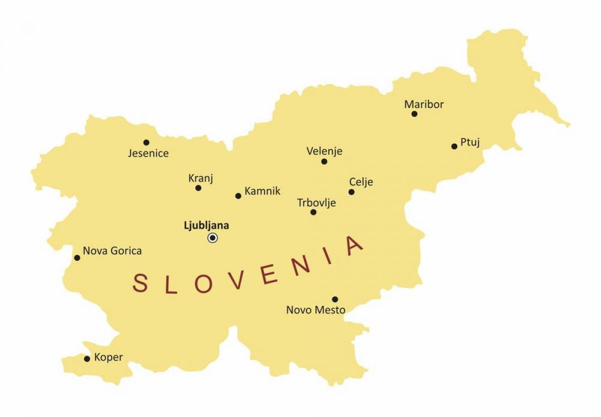
The capital of Slovenia map shows the main city of Slovenia. This capital map of Slovenia will allow you to easily plan your travel in the capital of the country Slovenia in Southern Europe. The capital of Slovenia map is downloadable in PDF, printable and free.
Ljubljana (locally: [lʲubˈlʲana]); German: Laibach, Italian: Lubiana, Latin: Labacum or Aemona) is the capital of Slovenia and its only centre of international importance. It is located in the centre of the country in the Ljubljana Basin, and is the centre of the City Municipality of Ljubljana. With approximately 272,000 inhabitants, it classifies as the only Slovenian large town as you can see in the Capital of Slovenia map. Throughout its history, it has been influenced by its geographic position at the crossroads of the Slavic world with the Germanic and Latin cultures. For centuries, Ljubljana was the capital of the historical region of Carniola. Now it is the cultural, educational, economic, political and administrative centre of Slovenia, independent since 1991. Its transport connections, concentration of industry, scientific and research institutions and cultural tradition are contributing factors to its leading position.
After World War II, Ljubljana became the capital of the Socialist Republic of Slovenia, part of Communist Yugoslavia, a status it retained until 1991, when Slovenia became independent. Ljubljana remained the capital of Slovenia, which entered the European Union in 2004. The capital city of Slovenia, with an area of 163.8 square kilometres (63.2 sq mi), is situated in central Slovenia in the Ljubljana Basin between the Alps and the Karst. Ljubljana is located some 140 kilometres (87 mi) west of Zagreb, 520 kilometres (320 mi) northwest of Belgrade, 250 kilometres (160 mi) east of Venice, 350 kilometres (220 mi) southwest of Vienna and 400 kilometres (250 mi) southwest of Budapest as its shown in the Capital of Slovenia map. The extent of Ljubljana has changed considerably in the past 30 years, mainly because some of the nearby settlements have merged with Ljubljana.
The capital city of Slovenia has a mix of styles of architecture. Despite the appearance of large buildings, especially at the city edge, Ljubljana historic centre remains intact. Although the oldest architecture has been preserved from the Roman period, Ljubljana downtown got its outline in the Middle Ages. After the 1511 earthquake, it was rebuilt in the Baroque style following Italian, particularly Venetian, models as its mentioned in the Capital of Slovenia map. After the quake in 1895, it was once again rebuilt, this time in the Vienna Secession style, which today is juxtaposed against the earlier Baroque style buildings that remain. The large sectors built in the inter-war period often include a personal touch by the architects Jože Plečnik and Ivan Vurnik. In the second half of the 20th century, parts of Ljubljana were redesigned by Edvard Ravnikar.